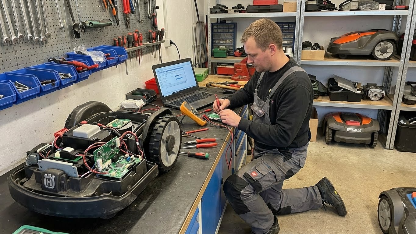

Lost Its Way? How to Troubleshoot and Reset Your Mower’s Navigation System

When your robotic mower begins circling aimlessly, beeping at a familiar tree, or stubbornly refusing to leave its dock, its most critical system has failed: its sense of place. For high-end models that rely on precision navigation, this isn’t a minor glitch—it’s a complete breakdown of their core intelligence. A simple reboot rarely fixes it. Restoring reliable navigation requires a methodical, clinical approach to diagnose whether the issue lies in its “eyes” (sensors), its “brain” (processor/map), or its “nervous system” (the connection between them).
A lost mower is more than an inconvenience; it’s a liability that can damage landscaping and undermine trust in your automated system. This guide provides a professional-grade troubleshooting protocol, moving from quick fixes to deep system resets, ensuring your mower not only recovers its way but does so with enduring reliability.
Phase 1: The Initial Diagnosis – Understanding the Symptoms
First, classify the erratic behavior. The specific symptom points to the underlying cause.
-
Symptom: “Random Walk” or Spinning in Circles.
-
Likely Cause: Complete loss of positional fix. The mower has no idea where it is. This is common with standard GPS models under thick tree cover or during poor atmospheric conditions. For RTK systems, it means the connection to the base station is broken.
-
-
Symptom: Consistent Drift or “Phantom Obstacles.”
-
Likely Cause: Corrupted or offset map data. The mower knows its general location but its internal map no longer matches reality. It may try to drive through a fence or stop where there’s no obstacle.
-
-
Symptom: Refuses to Leave Dock or Aborts Mission Immediately.
-
Likely Cause: Dock location error or perimeter signal loss. The mower cannot establish a reliable starting point or believes the work area is inaccessible.
-
-
Symptom: Works in One Zone But Not Another.
-
Likely Cause: Localized signal obstruction or a corrupt zone boundary. A specific area of your yard (e.g., under a dense oak, near a metal shed) is creating a navigation dead zone.
-
Action: Observe for 2 minutes. Note the exact behavior and location. This is your first diagnostic data point.
Phase 2: The Field Triage – Immediate Actions
Before diving into complex resets, perform these critical on-site checks. Always ensure the mower is stopped and blades are off.
Check 1: The Physical Connection (For RTK Systems)
-
Inspect the RTK Base Station: Is its LED status light solid green (or per manufacturer’s “normal” indication)? Is it still firmly mounted with a clear, unobstructed 360-degree view of the sky? Has it been disconnected from power or Ethernet?
-
Check for Physical Damage: Look for frayed cables, a tilted antenna, or insect nests in the housing.
Check 2: The Localized Interference Scan
-
New Structures? Have you installed a new metal gazebo, shed, or large satellite dish since the last successful mow?
-
Seasonal Changes? Has spring foliage fully leafed out, creating a new canopy that blocks satellite signals? Are there new piles of mulch or construction materials?
-
Electromagnetic Noise: Is the dock located near a newly installed transformer, large motor, or unshielded electrical panel?
Check 3: The Basic Sensor Reboot
-
In the app, command the mower to return to dock.
-
At the dock, power it down completely via the physical button.
-
Clean all sensors and cameras with a dry microfiber cloth. A single spiderweb over a vision camera can blind it.
-
Power it back on and wait 5 minutes for it to reacquire all signals.
Phase 3: The Software & Data Reset Protocol
If triage fails, the problem is likely in the software or data. Proceed in this order, from least to most invasive.
Step 1: The “Soft” Map Reset (Re-establishing Position)
-
Action: In your app, find the option labeled “Update Position,” “Refresh GPS,” or “Re-sync with Base Station.” This forces the mower to discard its temporary positional data and get a fresh, high-quality fix from its satellites or RTK base.
-
When to Use: For general “lostness” or drift.
Step 2: The “Corridor” Test (Isolating a Map Problem)
-
Action: Create a new, simple test. In your app, define a small, open rectangular work area (e.g., 20 ft x 20 ft) that does not include the trouble spot. Send the mower to work only in this new zone.
-
Diagnostic Result:
-
If it works perfectly: Your main map or a specific zone boundary is corrupted.
-
If it still fails: The problem is with the mower’s core hardware or sensor suite, not your yard’s map.
-
Step 3: The Navigation System Recalibration
-
Action: Access the “Service” or “Advanced Settings” menu in your app. Look for “Calibrate Compass,” “Gyro Reset,” or “Wheel Odometry Calibration.” Follow the on-screen instructions, which often involve driving the mower in a slow square on a flat, open surface.
-
When to Use: After replacing wheels, after a physical impact, or if the mower consistently curves when trying to drive straight.
Step 4: The Nuclear Option – Factory Reset & Re-mapping
Warning: This erases all maps, schedules, and zones. It is the last resort before a service call.
-
Backup Data: Note down your zone boundaries or take screenshots of your map.
-
Factory Reset: Find the “Reset Navigation System” or “Restore Factory Map” option. Confirm.
-
The Re-Mapping Ritual: This is not just repeating setup; it’s a chance to do it better.
-
Choose optimal conditions: clear sky, dry ground.
-
Use the “Precision Mapping” mode if available, often involving walking the boundary with a remote beacon for RTK systems.
-
Re-define zones with generous margins from known problem areas (dense trees, metal structures).
-
Phase 4: The Proactive Architecture – Building Navigation Resilience
True expertise lies in designing a yard that is inherently easy to navigate.
-
The “Signal Highway” Principle: Ensure there is a wide, open-sky corridor between your RTK base station/dock and every part of your yard. Trim overhanging branches that create signal-choke points.
-
Strategic Use of Virtual vs. Physical Boundaries: In areas with perpetual GPS multipath (e.g., between two close, tall fences), consider using an old-school perimeter wire for that section only, letting the mower use its precise navigation everywhere else. Many high-end systems support this hybrid mode.
-
Establish Maintenance Waypoints: Place small, subtle visual markers (a specific garden stone, a post) at the corners of your virtual zones. During your monthly walk, verify the mower’s physical path aligns with these digital markers, catching drift early.
When to Call for Reinforcements: The Limits of DIY
Contact professional technical support if:
-
Persistent Hardware Errors: The app shows consistent failures for specific components (e.g., “Compass Error F29,” “Wheel Encoder Fault”).
-
Failed Factory Reset: The mower cannot complete a new mapping run or displays the same errors post-reset.
-
Physical Damage: You suspect internal damage from water intrusion or an impact.
Provide the Support Team With: 1) The exact error codes from the app log, 2) A video of the faulty behavior, 3) The results of your “Corridor Test.”
Conclusion: From Passive Owner to Systems Navigator
Successfully troubleshooting a navigation failure transforms your relationship with the machine. You stop being a frustrated user of a black-box gadget and become the system administrator of a mobile robotic platform.
The process teaches you that reliability isn’t just about buying a premium mower; it’s about curating the signal environment in which it operates and understanding the layered architecture of its intelligence. By mastering this protocol, you ensure that the phrase “lost its way” becomes a rare diagnostic prompt, not a recurring complaint. You achieve the true goal of smart lawn care: not merely automation, but predictable, flawless, and silent execution, season after season.